We are able to provide these real-time tracking maps thanks to the generosity of Dr. Michael Coyne of Seaturtle.org. His organization maintains the Satellite Tracking and Analysis Tool (STAT), a free, open access, and valuable service that we use every day. STAT also is used by over 150 other research organizations around the world studying sea turtles, sharks, marine mammals and birds.
For more information on Seaturtle.org and the vast array of wildlife tracking projects they serve, visit their website: www.seaturtle.org. You also may wish to consider supporting their valuable work financially.
White-crowned Pigeon
Project Title
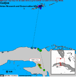
The contribution of satellite telemetry to the conservation of White-crowned Pigeons in the Caribbean
Description
Seasonal movements of White-crowned Pigeons tracked by satellite telemetry: Identifying trans-national threats, management needs, and conservation opportunities throughout the Caribbean.
The White-crowned Pigeon (Patagioenas leuccocephala) is a wary, tropical fruit eating species restricted to the Caribbean Basin, the Bahamas, and extreme southern Florida. These birds are the primary seed dispersers for the increasingly threatened West Indian hardwood-hammock plant community. White-crowned Pigeons are migratory, making long over-water flights between breeding and wintering areas throughout their range, but wintering destinations of specific breeding populations are poorly known and migratory flights apparently take these birds to a wide range of destinations relative to their nesting locale.
Within the Caribbean region, the White-crowned Pigeon is widely distributed but threatened due to hunting, poaching, and loss of essential habitats. With the use of satellite telemetry we are determining the annual, range-wide movements of adult White-crowned Pigeons from representative breeding populations. This study will inform wildlife managers of the seasonal changes in distribution, threats, and survival that dictate the conservation needs of this highly-mobile and widely-hunted species.
ARCI’s Project Partners
Project coordinators:
- ARCI (Ken Meyer and Gina Kent)
- BirdsCaribbean (Lisa Sorenson)
- U.S. Fish and Wildlife Service (Frank Rivera-Milan)
Collaborators:
- National Trust for the Cayman Islands (Paul Watler et al.)
- Jamaica National Environment and Planning Agency (Ricardo Miller)
- Bahamas National Trust (David Knowles, Denny Moore)
- Puerto Rico Department of Natural and Environmental Resources (Alexis Martinez; with Sheylda Diaz)
- Instituto de Ecologia y Sistematica, Cuba (Lourdes Mujica and Martin Acosta)
- Florida Keys National Wildlife Refuge Complex (U.S. Fish and Wildlife Service, Tom Wilmers)
Supporters
This project is funded through the U.S. Fish and Wildlife Service, including support from the Florida Keys National Wildlife Refuges Complex, and a grant from Neotropical Migratory Bird Conservation Act.
Go to the White-crowned Pigeon tracking maps
Reddish Egret
Project Title
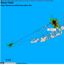
Breeding and foraging ecology, threats, and causes of decline of Reddish Egrets in Florida
Description
The Reddish Egret (Egretta rufescens), the rarest wading bird in the U.S., is a highly specialized feeder ecologically restricted to a very narrow coastal habitat that is vulnerable to human disturbance, storm effects, and climate change. The Florida population is estimated at 350-400 pairs, with 100-125 in Florida Bay and Keys. The latter sub-population appears to be steadily declining. In 2009, we began research based on satellite telemetry in the Florida Keys and are now expanding this study to include the Gulf and Atlantic coasts of Florida. Our results will address important management topics, including habitat and area needs, seasonal movements, site fidelity, breeding effort, survivorship, and sources of mortality. Telemetry data combined with direct observations suggest strong site fidelity with limited seasonal movements; highly competitive and aggressive foraging interactions; lower-than expected adult; and narrow habitat selection, which may further constrain this small resident population.
ARCI’s Project Partners
ARCI has collaborated with Tom Wilmers (U.S. Fish and Wildlife Service) and Stefani Melvin (formerly U.S. Fish and Wildlife Service). Our conservation partners include members of the Reddish Egret Working Group, with whom we are drafting a range-wide conservation strategy and management plan in cooperation with the U.S. Fish and Wildlife Service.
Supporters
- U.S. Fish and Wildlife Service
- Florida Keys National Wildlife Refuges
- Friends and Volunteers of Refuges (FAVOR)
- Florida Keys Audubon Society
- Felburn Foundation
- Sanibel-Captiva Audubon Society
- International Osprey Foundation
- Ding Darling Wildlife Society
Go to Reddish Egret tracking maps
Snail Kite
Project Title
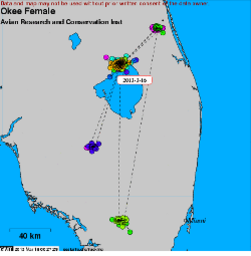
Movements and foraging of Snail Kites relative to habitat, prey, and contaminant conditions
Description
The Snail Kite’s (Rostrhamus sociabilis) U.S. distribution is limited to Florida. Snail Kites feed almost entirely on a single species, the Apple Snail (Pomacea paludosa), which is influenced by the timing and distribution of surface water conditions. Striking declines in Snail Kites have been directly tied to human-caused changes in hydrology. The species is listed as Endangered federally and by the state of Florida. Our first satellite-tracking study (2007-2009) determined the differences in cost and effectiveness between satellite and VHF radio telemetry for locating marked Snail Kites following dispersal, for describing habitat use and home ranges, and for estimating survivorship. Survival over two years for this small sample (n=10) was 100% based on satellite telemetry, but VHF tracking of the same sample of birds (i.e., each individual carried a satellite and a VHF transmitter) estimated less than 50% survival over the same two-year period. Satellite tracking also produced significantly larger home-range estimates than VHF tracking and revealed short-term/long-distance movements to outlying activity centers that may represent refugia or other vital destinations during declining conditions. In 2012, we deployed satellite transmitters on 12 additional adult Snail Kites to study movements and habitat selection in relation to snail abundance (with UWF biologists), natural versus altered wetlands, toxins (copper and mercury), and proposed wind-farm developments. For this project, the satellite transmitters include GPS receivers capable of 10-15 meter accuracy. Such finely-scaled location data will inform critical management decisions for Snail Kites and the greater Everglades ecosystem.
ARCI’s Project Partners
- Phil Darby and Bethany Wight, University of West Florida
- Kristen Hart and Ronnie Best, U.S. Geological Survey
- Ikuko Fujisaki, University of Florida
- Bob Frakes, Emily Bauer, and Anthony Sowers, U.S. Fish and Wildlife Service
Supporters
- U.S. Fish and Wildlife Service
- U.S. Geological Survey
- Saint Johns River Water Management District
- South Florida Water Management District
- Microwave Telemetry, Inc.
- Palm Beach Zoo & Conservation Society
Go to Snail Kite tracking maps.
Magnificent Frigatebird
Project Title
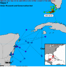
Movements of Magnificent Frigatebirds from communal roosts in the Florida Keys
Description
Magnificent Frigatebirds (Fregata magnificens) are thought to be declining across their range due to habitat destruction and human disturbance at nesting sites. They roost in the Florida Keys (breeding does not begin until at least five to seven years of age) and other coastal areas in the U.S., but only a single small nesting colony exists in this country, suggesting that virtually all birds at seasonal roosts in the U.S. were produced and are nesting in other countries. About 50% of the Caribbean breeding colonies have been extirpated. Because of their foraging habits and a widely dispersed prey base, Magnificent Frigatebirds may be acutely affected by climate change and resulting warmer sea temperatures. Protection of this species, therefore, requires international cooperation and management, yet the absence of ecological and movement data on Magnificent Frigatebirds in the U.S. confounds conservation planning. In collaboration with USFWS biologist Tom Wilmers, we deployed satellite/GPS tracking units on five Magnificent Frigatebirds captured at roosts in the Florida Keys National Wildlife Refuges. Our objectives are to determine for the first time where these birds breed, the timing of migration to and from breeding areas, patterns of seasonal movements, and fidelity to roost and nest sites.
ARCI’s Project Partners
- Tom Wilmers (U.S Fish and Wildlife Service)
Supporters
- U.S Fish and Wildlife Service
- Florida Keys Audubon Society
- Hernando Audubon Society
Go to Magnificent Frigatebird tracking maps
Swallow-tailed Kite

Project Title
Swallow-tailed Kite roose sites, migration, and conservation opportunities
Description
ARCI began tagging Swallow-tailed Kites in 1996 with the smallest satellite transmitters yet produced and soon discovered that the U. S. population’s migration pathway was much different and ended much farther away – over 8,000 kilometers – than had been imagined. By 2005, we had combined this dramatic new remote-sensing technology with direct VHF radio tracking in South America to confirm consistent annual movements over Gulf and Caribbean waters, Mexico’s Yucatan Peninsula, eastern Central America, and around South America’s Amazon Basin to wintering sites in the heterogeneous landscape of southern Brazil and nearby Bolivia. In 2011, to identify year-round habitat needs and range areas, determine critical breeding areas, estimate annual survival, and investigate migration and wintering threats, we began deploying the smallest ever GPS-equipped satellite transmitters. These devices provide up to eight locations each day, accurate to within 15 meters, for several years. This collaborative project with Dr. Jennifer Coulson was made possible by funding from the U. S. Fish and Wildlife Service and by Microwave Telemetry’s unscheduled development of a satellite/GPS unit small enough to be carried by a Swallow-tailed Kite. Such data will enable us to refine management recommendations and intensify conservation efforts where most needed throughout the Swallow-tailed Kites year-round range.
ARCI’s Project Partners
- Jennifer Coulson, Orleans Audubon Society
- Dean Demarest, U.S. Fish and Wildlife Service
- Billy Brooks, U.S. Fish and Wildlife Service
- Jim Lyons, U.S. Fish and Wildlife Service
Supporters
- Florida Fish and Wildlife Conservation Commission
- National Fish and Wildlife Foundation
- U.S. Fish and Wildlife Service
- Felburn Foundation
- Southern Company
- Georgia Department of Natural Resources
- Hernando Audubon Society
- Sanibel-Captiva Audubon Society
- International Osprey Foundation
- Microwave Telemetry, Inc.
- Palm Beach Zoo & Conservation Society
Go to Swallow-tailed Kite tracking maps
Great White Heron

Project Title
Habitat, movements, and conservation ecology of Great White Herons in the Florida Keys
Description
The Great White Heron (Ardea herodias occidentalis), with a very small global distribution restricted to Florida Bay and the Florida Keys, has undergone a substantial decline. This probably is due to decreasing fish availability, in turn tied to large-scale losses of sea grass beds. Since 2007, we have examined limitations of foraging habitat, dispersal and survival of juveniles, seasonal movements, and survival of adult Great White Herons tracked by satellite/GPS and VHF telemetry. Our goal is to explain the decline in Florida (i.e., the total U.S. population) and to recommend a management and conservation strategy. So far, we have learned that foraging efficiency is higher in the lower Keys than in Florida Bay based on effort and the sizes of captured prey. Nesting success in the Keys also exceeds that of Florida Bay. The herons exhibit strong site fidelity, with well-defined and repeatedly-used core foraging areas. Home range areas averaged 51 square kilometers and overlapped substantially for the five satellite-tracked adults. Large, continuous sea grass beds were used for foraging year round in significantly greater proportion than their availability. Patchy, discontinuous stands did not attract herons, highlighting the value of healthy, expanses of sea grass for producing the fish on which this large bird depends. Reproductive performance was lower in upper Florida Bay, where sea grass beds are more degraded. Based on VHF radio tracking, natal philopatry was the norm for two months after fledging, followed by sudden long movements that resulted in the subsequent loss of contact with nearly all of the 42 tagged juveniles (three were last detected in their third and fourth months post-fledging at 98, 130, and 210 kilometers north of their natal areas).
ARCI’s Project Partners
- Tom Wilmers (U.S. Fish and Wildlife Service)
Supporters
- Florida Fish and Wildlife Conservation Commission
- U.S. Fish and Wildlife Service
- Florida Keys National Wildlife Refuges
- Friends and Volunteers of Refuges (FAVOR)
- Florida Keys Audubon Society
- Felburn Foundation
- Sanibel-Captiva Audubon Society
- International Osprey Foundation
Go to Great White Heron tracking maps
Norther Harrier
Project Title
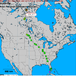
Annual movements of Northern Harriers migrating through the Florida Keys
Description
During the fall of 2010 and again in 2012, we deployed satellite transmitters on a total of five Northern Harriers (Circus cyaneus) migrating through the westernmost reaches of the Florida Keys. This study was a first attempt at identifying pathways, stopover sites, and wintering destinations for this long-distance migrant. Breeding and wintering Northern Harrier populations are at risk from a variety of human threats that have led to local population declines and extirpations. Our tracking results will fill knowledge gaps in the harrier’s life history and illuminate problems for this and other species that rely on the Florida Keys and, thus, are threatened by habitat loss and disturbance from human recreational activities and climate change.
ARCI’s Project Partners
Tom Wilmers (U.S. Fish and Wildlife Service)
Supporters
U.S. Fish and Wildlife Service
Florida Keys National Wildlife Refuges
Friends and Volunteers of Refuges (FAVOR)
Go to Northern Harrier tracking maps
Short-tailed Hawk
Project Title
Contributions of satellite telemetry to the conservation of Short-tailed Hawks
Description
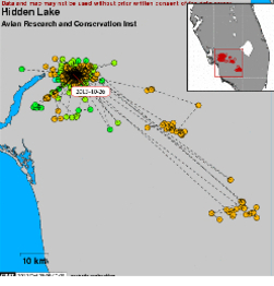
Since 2000, we have used satellite telemetry to monitor the year-round movements, habitat use, home range sizes, and survival of Short-tailed Hawks tagged as adults in Florida. The U.S. population of this raptor is very small – perhaps no more than 250 pairs – and restricted almost entirely to Florida. ARCI’s concurrent research on this species’ breeding ecology has revealed low nesting success due to unknown factors, selection of large stands of mature, closed-canopy forest as nesting sites, and exceptionally strong fidelity to breeding areas by individual birds with rapid replacement following the death of prior occupants. For these reasons, it is important to understand what Short-tailed Hawks require for foraging habitats and range sizes, particularly while nesting. Satellite telemetry is the best means of quantifying foraging needs for this forest-dwelling hawk. Our long-term tracking datasets are a valuable source of management information for the rare Short-tailed Hawk, particularly given that this bird’s remaining range falls within one of the most rapidly developing states in the country.
ARCI’s Project Partners
- Florida Fish and Wildlife Conservation Commission
- Felburn Foundation
